Humans create maps of so many land features. However, few tend to realize that there is much to map below the surface.
Caves are not something new. There's Mammoth Cave, the world's largest with the corresponding N.P. in Kentucky. The western U.S. boasts Cathedral Caverns, the interior of which exhibits many impressive cave formations while the main toursit entrance hosts mass bat flights around dusk. Wind Cave is another notable "hole in the ground".
One such cave truly does lie relatively low from public view. Lechuguilla.
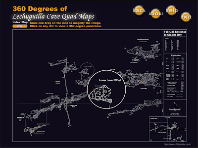
This week's map is a rendering of this cave. Lechuguilla, unlike the previously mentioned tourist caves, is somewhat preserved, and restricted to regular tourist visits. Entrance is only granted to specific individuals, sometimes scientists studying a cave that has been spared.
The given map is a glimpse of a package of software allowing users to view details and extent of mapped passages. Please see the main web site for further info. http://www.360parks.com/lechuguilla_cave_virtual_tour.shtml
Cave surveyers and/or cartographers use some map symbols that may be unfamilar to many land mappers. Please take note of the legend.


No comments:
Post a Comment